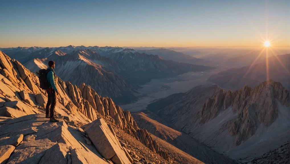
As you consider tackling the 6-day Mt. Whitney hike, it’s important to understand the commitment and preparation required for such an endeavor. Navigating through permits, weather conditions and physical readiness would be best. Each day offers unique challenges and spectacular vistas, from the dramatic ascent up the 99 Switchbacks to the tranquil beauty of Mirror Lake.
But what awaits you at the summit might alter your perspective on nature and your capabilities. Are you curious about how to prepare for and execute this transformative experience? Let’s explore the steps to ensure your journey is as successful as it is memorable.
Key Takeaways
- Research a multi-day route suitable for a 6-day expedition on Mt. Whitney.
- Secure a multi-day hiking permit via the lottery or check for cancellations.
- Plan daily mileage and campsites, ensuring compliance with designated camping zones.
- Pack appropriately for extended backcountry travel, including extra food and gear for varying conditions.
- Prepare physically and mentally for prolonged high-altitude exposure and challenging terrain.
Planning Your Route

Before beginning your Mt. Whitney adventure, it’s important to thoughtfully choose your hiking route. Each option requires a specific permit tailored to its unique challenges and experiences. If you plan a day hike to Whitney, the Mount Whitney Trail from Whitney Portal is highly recommended, especially for first-timers.
This trail provides a direct route to the summit and can typically be completed within 12-16 hours. Starting from the Whitney Portal campground, you’ll ascend the well-maintained Mount Whitney Trail, passing through stunning alpine landscapes and rugged terrains.
As you hike Mt Whitney, it’s essential to be prepared for the physical demand and aware of symptoms of altitude sickness, which can occur due to the high elevation. Reaching the Trail Crest, you’ll be almost there, with breathtaking views that are truly rewarding.
Whether you opt for a day hike or backpack, obtaining the right Mt Whitney permit is essential. Each permit, known as Whitney permits, is specific to the type of hike you choose, ensuring that your journey is both safe and compliant with local regulations.
Securing Necessary Permits
After selecting your route, you’ll need to secure a permit for your hike on Mt. Whitney, a process that can be competitive due to the popularity of the trail. Whether you’re planning a day hike or an overnight trip, obtaining a permit is vital due to the high demand and limited trail access.
Permits are mandatory and strictly enforced to manage foot traffic and preserve the natural environment. You can obtain your permit through a pre-season lottery, typically with a deadline of March 1st. It’s important to mark this date on your calendar, as missing this deadline could greatly reduce your chances of securing a permit.
If you’re set on tackling Mt. Whitney, entering this lottery is your best bet. However, don’t lose hope if you miss out on the lottery. Cancellations often occur, and these freed-up permits are available to enthusiastic hikers like yourself.
Keep a close eye on availability, and be ready to act quickly when a secured permit becomes available. By staying informed and persistent, you’ll increase your chances of experiencing the majestic heights of Mt. Whitney.
Essential Gear Checklist
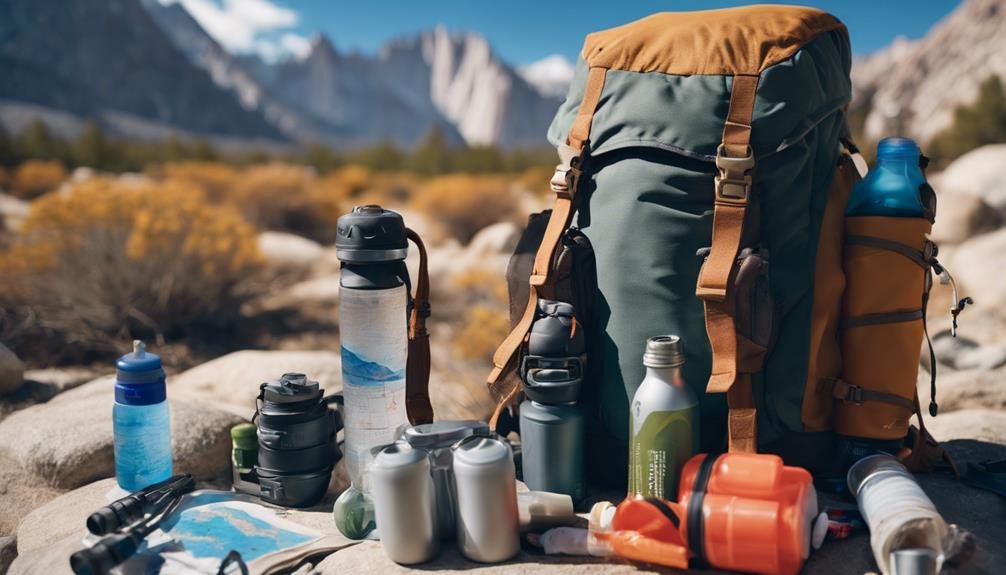
To successfully tackle the challenging terrain of Mt. Whitney, you’ll need to pack essential gear that guarantees both safety and comfort throughout the hike. First, invest in a sturdy pair of hiking boots designed for rocky terrain. These will provide the necessary support and grip, reducing the risk of slips or injuries. Dressing in layers is non-negotiable.
The mountain’s weather can shift rapidly, so layering allows you to adjust to changing conditions without much hassle. Include a moisture-wicking base layer, an insulating mid-layer, and a waterproof outer layer to tackle any weather Mt. Whitney throws your way. Here’s a concise list of must-haves for your adventure:
- Navigation Tools: Always carry a map and compass. These are your lifelines in the wilderness, ensuring you stay on the right trail.
- Sustenance: Pack enough high-energy food and water for the day. Staying hydrated and fueled is critical.
- Safety Gear: Don’t forget a first aid kit and a headlamp with extra batteries. Accidents happen, and trails can get darker than expected.
- Support Equipment: Consider trekking poles for extra stability and support on the uneven and steep sections.
Training for High Altitude
Preparing for a high-altitude hike like Mt. Whitney requires you to focus greatly on boosting your cardiovascular endurance and strengthening your leg muscles. Engaging in aerobic exercises such as running, cycling, or swimming will help increase your lung capacity, enhancing oxygen intake which is vital at high altitudes.
Strength training, particularly for your legs, is essential as the elevation gain on Mt. Whitney is significant. Incorporating altitude training into your regimen can vastly improve your acclimatization process. You can start by hiking at gradually increasing elevations or utilizing altitude simulation equipment to mimic the conditions you’ll face on the mountain.
This method helps your body adapt to the lower oxygen levels you’ll encounter. Hydration is another key component of your training. The dry, thin air at high altitude increases the risk of dehydration, which can severely impact your performance and health. Ensure you drink plenty of water before, during, and after your training sessions.
Weather Considerations
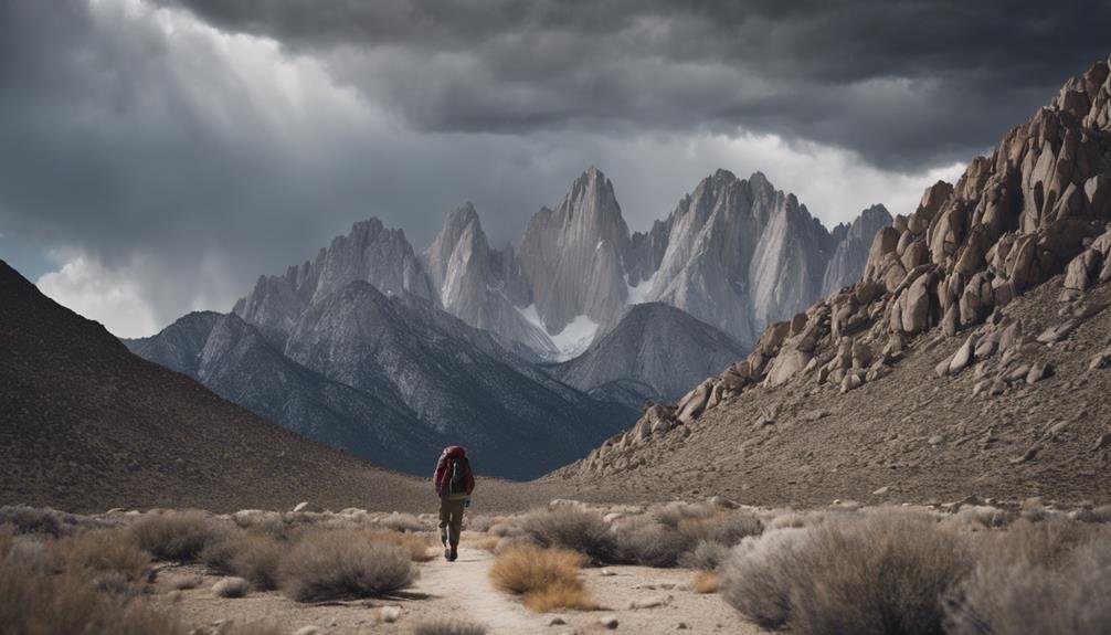
As you enhance your physical preparedness for Mt. Whitney, keep in mind that understanding the mountain’s unpredictable weather is just as crucial for a safe and enjoyable hike. The shifting conditions at different elevations can challenge even the most experienced hikers. Here are key weather elements to keep in mind:
- Temperature Variability: As you ascend, temperatures can decrease notably. While it might be warm at the base, the summit can be freezing, even in summer.
- Afternoon Thunderstorms: Common during the summer months, these can bring dangerous lightning, especially hazardous on exposed ridges.
- Snow and Ice: Even in warmer seasons, patches of snow and ice can linger on the trail, making some segments particularly slippery.
- High Winds: The winds can be fierce near the summit, requiring wind-resistant clothing and careful footing to avoid being knocked off balance.
Equip yourself with appropriate layers to adapt to these changes. A breathable base layer, an insulating mid-layer, and a waterproof outer layer are essential. Always check the latest weather forecasts before your hike, and be prepared to turn back if conditions deteriorate. Remember, safety always comes first on Mt. Whitney.
Daily Hike Breakdown
Starting the daily Mt Whitney hike, you’ll take on a strenuous 22-mile journey, climbing to the breathtaking summit at 14,505 feet. This day hike isn’t just a walk in the park; it’s an adventure that demands rigorous training and thorough preparation.
As you ascend, you’ll navigate through 97 switchbacks, each turn offering a unique perspective of the rugged terrain below. The path stretches before you, woven between the grandeur of granite spires that pierce the deep blue skies. Early in the morning, the air is crisp, and the light paints the peaks in hues of gold and amber.
Each step brings a new vista, more stunning than the last, rewarding your efforts and pushing you onward. As the altitude increases, so does the challenge. The thinning air requires your lungs to work harder, a reflection of the preparation you’ve undertaken for this day.
Remember, pacing is key; it’s not a race but a journey to be savored. Allow yourself moments to rest, hydrate, and soak in the sublime beauty surrounding you. Completing this 22-mile round trip in 12-16 hours is a feat to be proud of, a true badge of honor in the hiking community.
Post-Hike Recovery Tips

After completing your ascent of Mt Whitney, it’s important to focus on helping your body recover properly. The exhaustion you feel is a reflection of the day’s physical demands. Here’s how you can efficiently manage your post-hike recovery. Firstly, address your hydration and nutrition:
- Hydration: Drink plenty of water to rehydrate your body after the intense effort. Replenishing fluids is important to prevent dehydration and aid in muscle recovery.
- Refuel: Consume nutritious snacks like fruits, nuts, or protein bars. These foods provide the necessary nutrients your body craves after such strenuous activity.
Next, consider these important recovery tips:
- Stretching: Engage in light stretching exercises to ease muscle soreness and enhance flexibility. This step is crucial in helping your muscles relax and reducing the risk of injuries.
- Warm Shower or Cold Dip: Take a warm shower or, if you’re feeling brave, dip into a cold stream. Both options help soothe tired muscles and mitigate inflammation.
- Elevate Your Legs: Spend some time with your legs elevated. This simple act helps reduce swelling and encourages blood flow back to your heart.
- Rest and Sleep: Make sure you get plenty of sleep that night. Quality sleep is a cornerstone of effective recovery, allowing your body to heal and regain strength.
Conclusion
As you wrap up your 6-day Mt. Whitney adventure, reflect on the stunning vistas and personal triumphs. Securing your permits early and packing the right gear made each step safer and more enjoyable. Proper training paid off, allowing you to embrace the high altitudes and changing weather. With each day’s hike detailed in your mind, take these memories and recovery tips forward, already stronger for your next grand adventure in the wild.
Explore More Articles:
Explore the Arte Museum Las Vegas: A Must-Visit for Art Lovers
Balloon Museum Atlanta: Explore the World of Balloons
The Edge NYC: Breathtaking Views and Thrilling Adventures
